


 175 / 186

322
●
(MEXICO.)
Group of 6 18th-century Mexican imprints.
Various sizes, bind-
ings, and conditions.
Vp, 1753-93
[400/600]
Rodriguez. El dessemejante de si mismo . . . Loyola. Mexico: Rivera, 1753 * Arze de Miranda.
Sermones varios.Tomo Segundo only. Mexico: Bibliotheca Mexicana, 1755 * Ortega. Nueva albaja
apostolica. Mexico: Bibliotheca Mexicana, 1757 * Gomez Galvan. El sacerdote instruido en los min-
isterios de predicar y confesar. Mexico: Hogal, 1771 * Avila. Coleccion de noticias de muchas de las
indulgencias. Mexico: Zuñiga y Ontiveros, 1787 * Ruiz de Conejares. Sermon que en la solemne
funcion. Mexico: Zuñiga y Ontiveros, 1793. Medina, Mexico 4138, 4221, 4422, 5448, 7695,
8303.
323
●
(PERU.) Lasso de la Vega, García.
Histoire des Guerres Civiles des
Espagnoles dans les Indes.
2 maps, 5 (of 6) plates including engraved frontispieces. [18],
768; [10], 648 pages. 2 volumes. 12mo, contemporary vellum, moderate soiling; moderate
wear to maps, horizontal closed tear through lower margin of second frontispiece; title
pages in red and black. (GM)
Amsterdam, 1706
[300/400]
A later French translation of the Historia General del Peru.The first folding map depicts California
as an island. European Americana 706/90; Medina BHA 658n; Palau 354830; Sabin 98750.
324
324
●
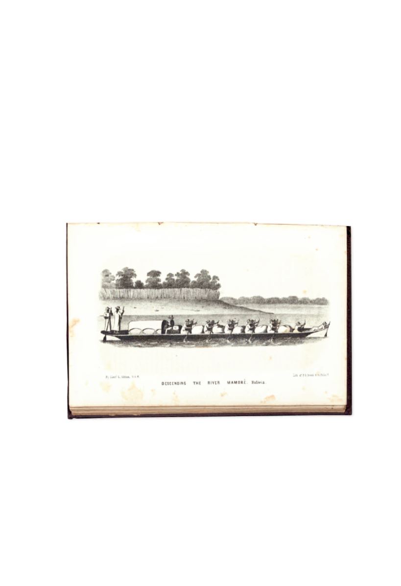
(SOUTH AMERICA.) Herndon, William Lewis; and Lardner Gibbon.
Exploration of the Valley of the Amazon.
4 folding maps, 52 plates, text illustrations.
[8], 417; x, [2], 339 pages. 3 volumes including a bound map volume. 8vo, publisher’s cloth,
minor wear, sunned, one map volume rebacked; moderate foxing, a few tears to maps. In
modern
1
/
2
morocco tray cases.
Washington, 1854
[400/600]
This report was the result of an early effort to open the Amazon River to American commerce.The two
explorers began at Lima. Herndon went north through Peru to the main branch of the Amazon;
Gibbon went south and explored tributaries in Bolivia, connecting with the Amazon further down via the
Madeira. Borba de Moraes, page 399 (“an excellent book on the regions mentioned”); Palau 113897;
Sabin 31524.
WITH
—a separately bound duplicate copy of the two maps found in the Gibbon report.
E N D O F S A L E