


 16 192

22
●
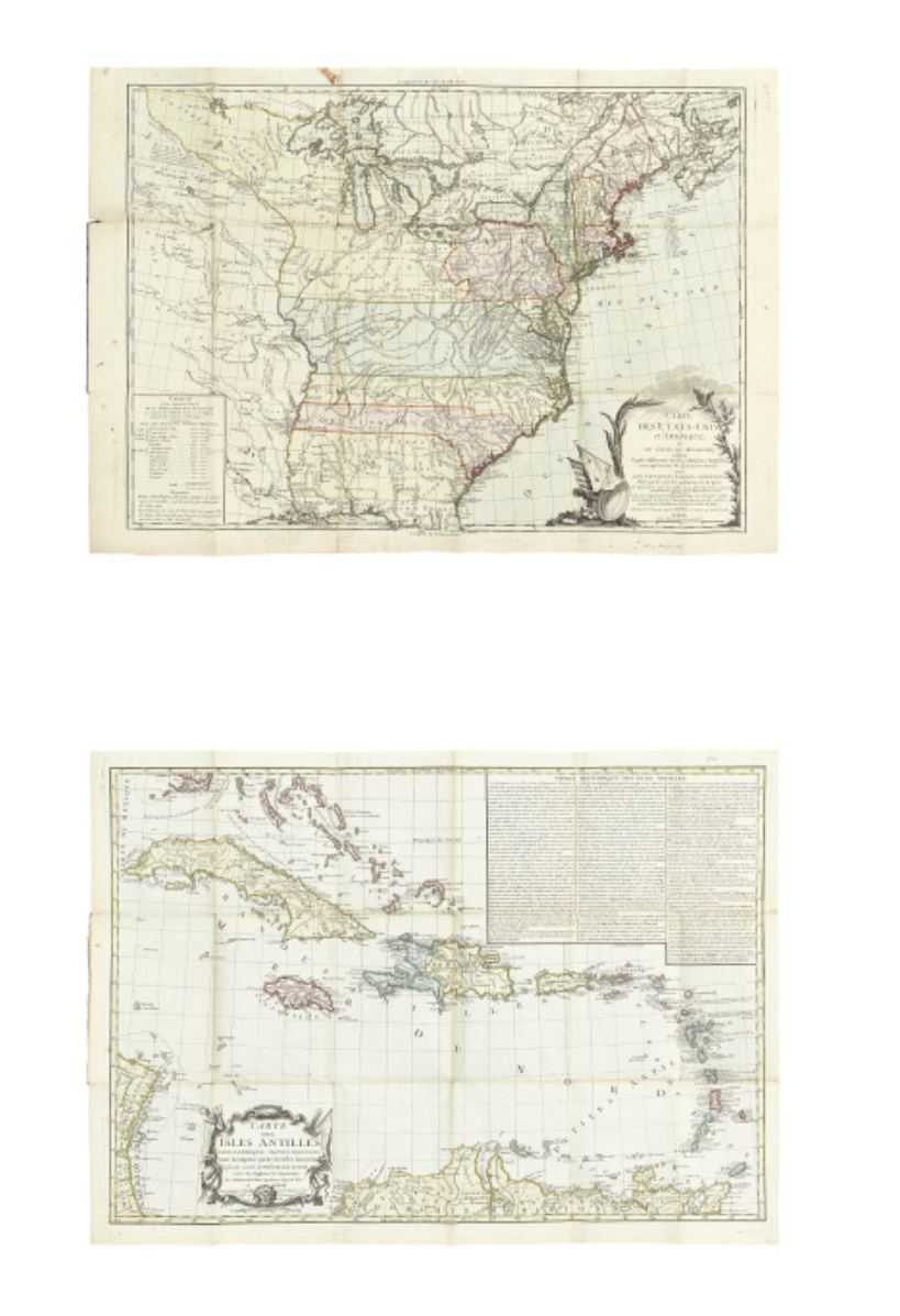
BRION de la TOUR, LOUIS.
Carte des Etats-Unis d’Amérique. * Carte des
Isles Antilles dans L’Amérique Septentrionale.
Together, two attractive maps
mounted in a contemporary blue paper folder, with title label. 550x775 mm (United
States); 560x785 mm (Antilles); old hand-color in full; folder split down the middle.
A VERY
ATTRACTIVE PRESENTATION
.
Paris: 1783 * 1782
[1,200/1,800]