


 14 192

21
●
BRIGGS, HENRY.
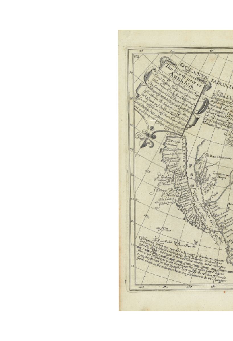
The North
p a r t o f Ame r i c a Co n t e y n i n g
Newfoundland, new England,Virginia,
Florida, new Spaine, and Noua
Francia… and upon ye West the large
and goodly Iland of California.
Double-page engraved map of North
America with California as an Island.
335x375 mm, wide margins top and bot-
tom, ample at right and left, blank verso;
two small worm tracks, tape stain at top
edge around central vertical fold.
[London, 1625]
[8,000/12,000]
A cornerstone map for the Califronia as an
Island collector and generally a very important
early map for the English colonies in North
America.
“Briggs extraordinary map was one of the very
first to show California as an island, and it
was the most influential in disseminating this
misconception.” Cohen, Mapping the West,
page 36.
“Henry Briggs was a leading mathematician of
his day . . . Engraved by Reynold Elstracke,
the map contains three legends. Two of these
show clear knowledge of the journals of a number
of the Northwest Passage explorers. Briggs
refers to the various tides found and uses them
as evidence that a sea route exists to the South
Sea or OCEANUS IAPONICVS.The third
begins, ‘California somtymes supposed to be a
part of ye westerne continent, but scince by a
Spanish Charte taken by ye Hollanders it is
found to be a goodly Ilande. . . .’ recording the
Spanish origins of this theory.”— Burden 214.